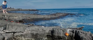
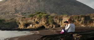
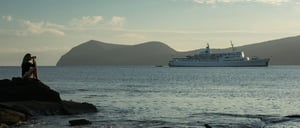
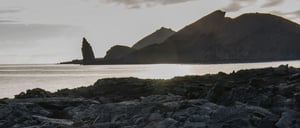
Buccaneer's Cove & Espumilla Beach
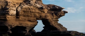
This is an amazing location featuring the remains of an eroded shoreline that is home to seabirds, fur seals, and playful sea lions. Its different shapes have been made throughout and erosion process of the salty waves and wind. Espumilla beach is a white-sandy front located in James Bay very popular among visitors.
Espumilla is a typical Ecuadorian dessert made of fruit and eggs which consistency is very similar to a foamy dessert which can also describe the foamy waves of this site. There are mangroves and a small palo santo forest that lead to salty lagoons that are home to wading birds such as flamingoes.
In the upper dunes, marine turtles nest can be also observed. The clear waters are a great place to snorkel to see assorted fish and rays.

- Disembarking: Wet.
- Type of Terrain: Sandy.
- Difficulty: Low.
- Activities: 1 hour hike / 45 min beach snorkeling.
- Highlights: Volcanic black beach and wonderful landscapes, fur seal grottos, sea lion colonies, herons, hawks, oystercatchers, finches, doves, white-tipped sharks, sea turtles. We will be able to see the vegetation from arid to humid climate zones, but they have been seriously affected by intensive foraging by introduced goats, now eradicated. The surrounding area is a prime place for spotting and observing hunting herons-namely Great Blue Herons, Yellow-crowned Night Herons, and Lava Herons- as well as oystercatchers. Visitors will enjoy the sight of marine iguanas grazing upon algae beds at low tide, sharing space with the crimps on red Sally light-foot crabs and other wading birds.
FUR SEAL
SEA TURTLE

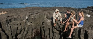
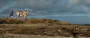
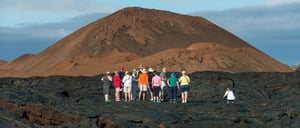
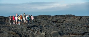
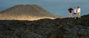
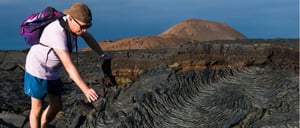
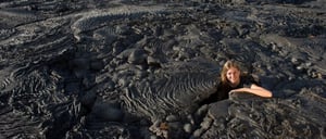
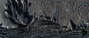
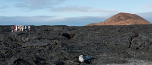
Sullivan Bay
This visitor site is located at the southeastern portion of Santiago Island and represents a great important geologic interest; it features extensive lava flows which are believed to have been formed during the last quarter of the 19th century. The area is covered by Pahoehoe lava flows (Pahoehoe wich means in Polynesian language “easy to walk”); this type of lava is rare to the rest of the world but is common to the volcanoes of the Galapagos Islands and Hawaii, as they share the same volcanic origin.
You can see the path of lava flow as well as the various igneous rock structures formed from varying rates of flow, temperature of formation and pressure. Visitors can also find pioneer plants and “hornitos”, little ovens formed when bubbles escape from hot lava to form mini-volcanoes.
At 492 ft (150 m) from the beginning of the path, molds of some trees can be found. Details of the crust indicate that they were trees growing in small crevices where soil and moisture accumulate in sufficient quantity so they can grow.
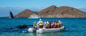
After exploring the lava flow, you can swim and snorkel with playful sea lions off two small coralline beaches.

- Disembarking: Wet.
- Type of Terrain: Flat & Petrified Lava.
- Difficulty: High.
- Activities: 1 hour 30 min hike / 1 hour snorkeling or beach time.
- Highlights: This is the perfect place to see and feel the volcanic origin of the Galapagos.
GALAPAGOS HAWK
SEA TURTLE

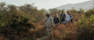
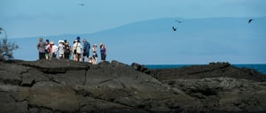
Egas Port
Egas Port named in honor of Jorge Egas, an entrepreneur who explored the island in the 1930s and opened a salt mine at the foothill of “Sugarloaf” Volcano. The site was actually visited in 1835 by the HMS Beagle and Charles Darwin, who described in his journals, a group of Spaniards salting tortoise meat with the salt extracted from the area.
The first part of the trail is comprised of volcanic ash (a tuff cone) and the other half of the trail is partially uneven terrain, comprised of volcanic basaltic rock that lounges the shoreline.
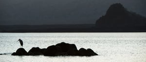
Along the shore, you can also find various bird species such as pelicans, blue-footed boobies, lava herons, yellow-crowned, night herons (locally called huaques), semi-palmated plovers, willets, yellow warblers, finches, and the highly territorial American oystercatchers, which usually lives in pairs that can occupy large extensions of the shoreline. We can also see sally light-foot crabs and large colonies of marine iguanas sunbathing on the volcanic rocks.
You have the option to visit the Salt Mines a trail of an approximate distance of 4 mi (8 km) round trip. It is a salty lagoon that’s located inside a crater.

- Disembarking: Wet.
- Type of Terrain: Flat & Semi-rocky.
- Difficulty: Medium.
- Activities: 2 hour 30 min hike / 1 hour 30 min beach snorkeling.
- Highlights: Volcanic black beach and wonderful landscapes, fur seal grottos, sea lion colonies, herons, hawks, oystercatchers, finches, doves, white-tipped sharks, sea turtles. We will be able to see the vegetation from arid to humid climate zones, but they have been seriously affected by intensive foraging by introduced goats, now eradicated. The surrounding area is a prime place for spotting and observing hunting herons-namely Great Blue Herons, Yellow-crowned Night Herons, and Lava Herons- as well as oystercatchers. Visitors will enjoy the sight of marine iguanas grazing upon algae beds at low tide, sharing space with the crimps on red Sally light-foot crabs and other wading birds.
FUR SEAL
SEA TURTLE